Showing posts with label transport. Show all posts

Saturday, October 31, 2015

Improving the Pedestrian Experience: The Cheap Way

Improving the Pedestrian Experience: The Cheap Way

Traffic improvements may sometimes be cheap. Below I show how to enhance the walkways around a University of Washington (UW) building, Schmitz hall, in Seattle at University Way and 41th street.

A bit of background. University Way is a lively shopping street one block west of the UW campus. It is a major pedestrian destination and also an important connection street. UW campus begins one block east of it, on the other side of 15th avenue. At the end of Campus Parkway (40th street) there is a much used walkbridge over 15th. Schmitz hall is located just between the walkbridge and University Way and hence a major walking corridor embraces it from both sides.

Let's start from north, approaching the campus from University Way (see the picture). We don't want to follow the sidewalk straight down (south)—then we have to climb up later again to reach the walkbridge. We take instead the level walkway around the hall, either by turning left, or south. However, as you can see, the most direct route to the walkway is blocked by a small decorative wall. This is the first cheap improvement: just remove the wall.

A decorative wall blocking the direct route
NW corner of Schmitz Hall at University Way (right) and 41th street. The walkbridge is at the SE corner of the building, behind it at left.

Compared to typical Seattle sidewalks, the walkway is surprisingly spacious. Unfortunately, a half of it is blocked by short stairs, leading to the sidewalk at about 1m above it (see the picture below). This makes a large swath of the walkway unsuitable as a connector route. I don't know if it is used for anything else. Note that even the narrow gap between stairs and a concrete pillar is blocked by a trashcan.

Otherwise wide walkway rendered narrow by stairs
The walkway on the north side of Schmitz Hall. The wider left-hand side is mostly blocked by stairs (middle-left on the picture).

But the next picture indicates just how easy it is to recover almost half of its walkable width: a) move the bin; and b) remove the lower part of the concrete wall that lines the stairs. Metal handrails are enough for safety. You may even shorten the handrails a bit at the lower end. This is easy and cheap.

Bad placement of trashcan
A trashcan is placed in the narrow passage between stairs and a concrete pillar.

The next obstacle is a bike rack. Well, not the rack itself but the bikes that extend far out of the rack. Fortunately the solution is easy: turn the rack 90 degrees and move it over to the left side.

Bad location for bike rack
The bike rack is placed gently between the columns. Unfortunately, the bikes occupy most of the walkway.

After passing the rack we reach the bridge with no further obstacles. However, there is another issue that can easily be solved. A bus stop is located at the 15th avenue, just at the end of the footbridge. Unfortunately, as the street is about 1m lower than the walkway at the end of the footbridge, one has to walk around the waiting shelter ("out of the picture" on right-hand side). This adds about 15 seconds to the walking time compared to the direct route.

Bus stop with no direct access
Those arriving from campus over the walkbridge (visible in the background) must walk around the shelter to get to the bus. One should construct stairs at the direct line between the bridge and where the bus stops—in the center of the picture. The bus stands on 15th avenue, a wall of Schmitz Hall is visible in the upper right corner.
15 seconds feels rather long when the bus is just coming, and as a handy shortcut, many jump the wall instead. Indeed, this is a place where one can easily add small stairs.
Direct route to the bus stop includes jumping this wall
Landscaping beneath the wall indicates that many passengers do not take the trip around the shed but just jump.

*

We need more attention to small details when desiging transportation infrastructure. The examples above indicate that improvement can sometimes be achieved with very little costs, or even at no cost if such considerations are taken into account in the original design. We need more awareness and understanding of pedestrian mobility at least as much as money. In this case it is about directness and space: we don't want to go around if a direct route is just here, and we don't like narrow passages.

*

AD ENDUM: I moved the bike rack out of way.

Bike rack out of way
Bike rack moved out of way

Tuesday, July 28, 2015

Gas Tax May Be a Simple and Good Enough Road Usage Charge

Gas Tax May Be a Simple and Good Enough Road Usage Charge

US road maintenance is underfunded. Unfortunately, current politics does not offer any sustainable funding ideas either. Instead, we hear about various one time patches like playing with custom tariffs or selling strategic oil reserves.

A good funding mechanism is based on the following principles:

  1. It creates a steady income.
  2. The Income grows and falls according to the road maintenance needs. This means it is related to the total driving mileage.
  3. The funding burden is closely associated with individual road usage, in particular the damage one causes to the road structures when driving.
  4. The mechanism is largely inflation-proof and does not require frequent political interference.

I-110 in Los Angeles
Freeways permit fast uninterrupted travel through dense urban environments. But they are not cheap. I-110 in LA.
By Adrian104 [Public domain], via Wikimedia Commons

In recent years we have seen an increased interest for "road usage charge", a user fee that depends on the actual driving mileage. Indeed, modern technology (currently tested in Oregon) allows to determine the exact mileage on different types of roads, and to send the driver the bill afterwards. Here I argue that we do not have to wait for the a technology to mature, as old-fashioned gas tax may serve as a good substitute for a smarter driving distance fee. I solely focus on road maintenance funding, and ignore congestion, pollution, and climate issues. Note that from this perspective there is no difference between fossil fuel, biofuel, and electric cars.

*

Two arguments strongly favor gas tax over alternative funding mechanisms: it's simplicity and it's focus on road users. The main objections are related to it's impact on economy, and the fact that it is less than perfect measure of actual road usage.

  • Gas tax is simple to introduce, collect and pay. First, the direct payments are done by big oil market operators who can easily handle a rather minor additional administrative burden. Second, most governments already collect it, hence the additional administrative burden would be even smaller. Third, such "pay-at-pump" scheme is the simplest imaginable tax for motorists. You pay for your gas and that's it.

    This contrasts to the proposed distance charge which is to be payed individually by millions of drivers. Hence the aggregated administrative burden for both private actors and public administrators is most likely higher. The distance tax must also be payed monthly or yearly, based on the actual driving, in a similar fashion as we currently do with the electricity bills. This also means the drivers have to keep some funds available for the tax payments later.

  • Gas tax is payed according to road usage—the more you drive, the more you pay. Unfortunately, this correspondence is less than perfect. Cars come in different fuel economy and size and stress the roads differently. This is potentially the main objection against funding roads solely by gas tax.

    Heavy truck
    Heavy transport stresses the roads substantially more than small cars. Although trucks burn more fuel than cars, the gas tax may not compensate for the additional stress on roads. Here weight-dependent usage charge may have an advantage.
    By bilbobagweed (formby) [CC BY 2.0 (http://creativecommons.org/licenses/by/2.0)], via Wikimedia Commons

    But save the road usage charge, gas consumption is still far closer indicator of individual "road consumption" than any other alternative, such as income or sales tax. If gas tax is too crude a measure, how on earth can sales tax be a better one? But sales tax is widely used for funding transportation projects.

  • Gas tax is often claimed to be a burden to the economy. But the picture is more complex. Sure, taxes hurt, but I don't see why should gas tax hurt more than the other taxes, in particular business and payroll taxes. If we introduce it in revenue neutral way, i.e. we lower the other taxes by exactly the same amount as we rise the gas tax, it amounts to redistributing the tax burden from the rest of the economy to large gas users. It is not immediately clear what are the economic implications. Transport intensive sectors will probably lose (but it also depends on what happens with road quality and congestion) while "human-intensive" sectors win from lower income tax. This includes technology companies that rely on a large well-payed workforce. I do not see the effect being much different from that of a better targeted road usage fee.

  • Inflation diminishes the value of both gas tax and road usage charge in a similar way. Unless inflation-indexed, regular political decisions are needed to rise these accordingly. The usage charge possesses a clear advantage here as it does not depend on the vehicles' fuel economy. Gas tax must be adjusted both for inflation and fuel economy, usage charge only for inflation.

  • Finally, many people may dislike the idea of government knowing exactly where and how much we drive. And the corresponding technology itself is not safe either—the ways to screw such meters will probably advance as well.

*

We do not have to wait until a better technology solves the road funding problems. It may never arrive. Meanwhile, gas tax is a simple and good enough road usage fee. The problem is in politics, not in technology.

Wednesday, November 5, 2014

Veeriku-Näituse-Downtown: A Functioning Pedestrain Highway in Tartu

Tartu is not the best place to move around on foot.  Although not a big city in terms of population, large business areas are impractically far for pedestrians, and there are few convenient options to cross roads, the river and the railway even in the urban core.  It also seems like the municipality has little clue what makes pedestrians thrive in the city.  But Tartu has examples of rather well functioning solutions.  One of these connects Veeriku neighborhoods over Näituse street to the inner city.  This route includes many such details that make a street a place where people thrive.  It also includes a number of obstacles, many of which can be easily fixed. Let's start from Veeriku.

A number of streets merge at the far end of Näituse making it the shortest route to downtown for many residential neighborhoods.  There are not too many cars and the sidewalks are of adequate width and quality.

 Far end of the Näituse street.  The sidewalks are wide enough and good enough here given the moderate number of cars.

 Unfortunately, the sidewalks turn less-than-adequate rather soon.  Up to the railway crossing, they are muddy and too narrow.  This is partly because of broken pavement, and partly because of the potholes in the roadway.  The situation might be acceptable for an unimportant street but not for such a central "pedestrian thoroughfare."  These problems are easy to fix by widening and improving the pavement.
Näituse street approaching the railway crossing.  The walkway suffers from broken pavement that renders it rather narrow on rainy days.
The first real bottleneck is the railway crossing.  One can easily see two problems: first, both ends of it are muddy and unpaved, and second, the sidewalk is too narrow between the tracks.  In places, the walkable width is only about 0.5m, far too little for this much walked route.  The main roadway is very close to the walkers with virtually no separating barrier in-between, but as the rails are not suitable for driving at full speed, the pedestrians are saved from the worst of the motorized traffic.  Fortunately, it is plenty of space here to widen the footpath.  Note also that as only the left-hand-side of Vaksali street (when looking toward the inner city) has a pedestrian crossing, that side is perhaps more important than the other.
Näituse street railway crossing.  The sidewalk is too narrow, and of too low quality at both ends.  It can easily be widened here.

Across the rails, the street is beautiful, tree-lined and with a separate footpath.  This is very nice.  The pavement is of sufficient quality for walking (but not for cycling).  My main complaint here are the parking cars: too often they occupy a substantial part of the walkway.  This may be acceptable for unimportant streets, but on such a major route the motorists should show much more respect for pedestrians.
A car on the sidewalk on Näituse street.  For most walkers this is a little obstacle but it substantially disturbs cyclists.  Note that there is enough space in front of the car to move it out of the walkway.

The final part of Näituse street, down from Kastani, suffers from somewhat narrow sidewalks.  Fortunately, a lot of pedestrian traffic heads to the other areas and cars are slow.  Further downhill, behind the wonderful Kassitoome, the sidewalks are just ridiculous.  In the lower end of the Baeri street, the right-hand side is far too narrow even for a single walker, and often cars are parking just next to it.
A sidewalk that is just plainly too narrow. Baeri Street.

The same is true around the Krooks pub: both sides are too narrow given the large number of pedestrians here.  In this place the street is substantially more important than in the beginning of our walk as it also connects Tähtvere and Supilinn neighborhoods with the downtown.  Wider sidewalks are needed.

Jakobi street in front of Krooks pub.  The sidewalks are inadequate and pedestrians are forced to stay very close to cars.  One should narrow the roadway, give more space to walkers, and install a speed table here.
The last obstacle, Jakobi-Lai crossing, recently got an adequate solution, although I was in favor of shortening the turn radius instead of installing the traffic islands.

It is rather easy to fix many of the existing problems. At the further end of Näituse street, one could simply widen the pedestrian area and pave it adequately.  There is plenty of space for it.  In the inner part of the city, this is not possible without squeezing the motorized traffic somewhat.  It is acceptable in my opinion, even in front of Krooks. One can remove one or two parking lots at the upper side of the street (these can potentially be moved over to the lower side) and widen the sidewalks on both sides by 0.5m.  This would roughly double the walkable width and make it a much more pleasant place. It is also a good idea to install a speed table to slow down cars driving so close to pedestrians.  Finally, parking on pedestrian areas must not be the default option.  If really necessary, one should take all the possible measures to avoid obstructing pedestrian traffic.

Sunday, April 6, 2014

What makes good bicycle tracks

I have already written here that most bicycle tracks in Tartu are of unacceptable quality.  Too often they are not direct, not smooth, and in places too narrow.  As it seems, the planners do not understand the basic needs of cycling.  Here I explain a little.
Bike track in Aarhus, DK.  It is smooth, and it goes straight across the junction.  The same priority rules apply both for cars and cyclists.
First, safety is important but not all-important.  I have seen claims that safety is almost the sole characteristic of the bicycle traffic. This is simply not true.  Bike tracks are not (just) about safety. They are about a combination of safety, accessibility, smoothness, and speed.  If safety were the all-important requirement, we would never cycle, never walk nor even drive small cars.  But we do.  We accept a low risk of injury if this helps us smoothly to get where we want to go.

Junction of Riia and Raudtee streets.  The bicycle track ends here abruptly at a guardrail (center).  The cyclists are supposed to take a sharp turn right, then left, cross the street at pedestrian speed, and continue on a very narrow sidewalk (right).  It is a safe but very inconvenient solution. A car lane at the same place (left) has neither abrupt turns nor other obstacles.  As the street goes downhill, cyclists can easily achieve speeds here comparable to those of cars.
In order to improve the biking conditions, one must plan the lanes with this suitable combination in mind.  If cycle lanes are very safe but the ride will not be fast and smooth, people will not choose cycling (or choose to cycle elsewhere).  In practice, the picture is complicated by the heterogeneous preferences by cyclists.  Broadly, kids and slow rider prefer safety, fast riders smoothness.  But it is perfectly possible to cater to all of them in most cases.  Usually it is achieved through street hierarchy—slow speed is enough inside a city blocks but large thoroughfares should allow full speed cycling (at least 30km/h).  Cyclists are exactly like motorists from this aspect.
Left: bike track between Maarjamõisa hospitals and University biomedical center.  Except for a few curbstones, this stretch is adequate for short-distance connection inside the university campus.  Due to it's location, it cannot be upgraded for high-speed connection between different parts of the city.  Right: bike track next to a major thoroughfare, Võru street.  Unlike cars, cyclists are supposed to yield at the small sidestreet and take an inconvenient turn just after the junction.  This is a place where the track should be upgraded to allow full-speed cycling.

Second, road users are always interacting and have to adjust to other road users.  This is partly achieved through planning of roads and junctions.  It is important to realize that adjustment is costly, usually involving breaking and speeding up again, and often maneuvering.  Current cycle tracks put too much of these adjustment costs on cyclists.  The tracks almost never go straight across intersections, even at the main thoroughfares, often forcing bikes to slow down to walking speed in order to cross curbstones and take sharp turns.  Second, instead of dedicated bike lanes, cyclists are often expected to ride on pedestrian walkways.  This is an acceptable solution only if these are wide and not crowded.  The most critical points are typically bus stops, turns around street corners, and areas near pedestrian crossings.  Sidewalks in these places are often narrow, visibility low, and many people standing and waiting.  Now compare this with the car lanes at the same stretches.  Those almost always retain their width, there are hardly ever obstacles like curbstones, and they go straight across the junctions.  Most of the the adjustment costs are shifted to cyclists and pedestrians.

Seems like the planners mainly follow two aims: the lanes must be safe, and the motorists should not bear the adjustment costs. Unfortunately, this leads to unusable cycle tracks.

Monday, January 27, 2014

Bicycle Lanes in Tartu

The last decade has seen a number of dedicated bike lanes built in and around Tartu.  Unfortunately, their functionality is rather limited. Below I explain why.
*

There are different cyclists.  In the one end we have slow local riders like children but also adults pedaling only a few blocks.  At the opposite end are regular fast commuters who move distances around 10km.  (I ignore bicycle racing and related issues here.)  Below, I explain what are the main problems with the existing lanes, in particular for the commuter group.

Junction of large roads as it ought to be: Nordre Ringgade crossing Nørrebrogade in Aarhus, DK.  The bike lane is just at left of the photographer, the markings are visible on street.  Note the lane is straight, and there are no curbstones.
First, the bicycle lanes should be straight.  The lane should be free of pylons, traffic lights but also pedestrians, and avoid unnecessary sharp turns.  In my opinion, this is the most problematic side of the current lanes.  All too often they are bent away from the street at junctions, and the bend typically includes a combination of a sharp turn, high curbstones and a
guardrail.  Hence one cannot cycle at typical speed for faster riders, 20-30 km/h, even along the major thoroughfares (like Võru street or Räpina road).
This is how it works in Tartu.  The guardrail works as a barrier and does not allow unhindered cycling.  But note the ongoing construction further down—the bend on the car lane is being smoothed out.  Junction of Tartu-Ülenurme road and Kuslapuu street (right).
Note that one almost never encounters such obstacles on car lanes.  It is also a safety issue, making cyclists less visible and rendering the right-of-way unclear.  Similarly, the existing cycle lanes almost never allow full-speed entry and exit.  Fast riders, notably out-of-town, cannot take sharp turns.  Hence the short dedicated tracks are seldom usable—the tiny gain in safety does not justify a large loss in speed.
Junction of large roads done wrong.  This is right-turn-lane of Aardla street joining one of the main thoroughfares, Võru street just ahead of us.  Note that just on this picture, cyclists are supposed to cross two curbstones and take a 90-degree turn on a rather narrow lane.  The only way to cross this junction at typical bike speed is to stay away from the bike lane.
Unfortunately, I have not experienced any improvement here over the years.  Even the newest tracks, like the one along the Räpina road, expect too much maneuvering and yielding from the cyclist.  Note that straightness is less of an issue for slow-speed local riders.  Hence the current quality of the track network may well cater for that group.

Second, the lanes should be direct and broadly follow the shortest path between the main destinations.  This is often a thorny issue as the shortest paths are typically occupied by large streets. For instance, neither Riia, Narva nor Võru streets have any dedicated cycle lanes despite offering direct access between large stretches of the city, and being often considered too dangerous for biking.  The suggested alternatives, Kesk street next to Võru and the way over Näituse street to reach Maarjamõisa hospitals, are substantially longer.  Directness matters for everyone, despite their distance and speed.

Third big issue is evenness.  Even street surface is a must.  The most problematic point here are the curbstones, but also the overall profile of the lanes.  A high-quality bike lane should not have any curbstones in the first place.  Second, the surface profile should be smooth enough.  If certain sections must be lower (for instance, to facilitate driving across the sidewalk), one should smoothly lower the lane level along a longer stretch.
Junction of a major thoroughfare, Võru street with a sidestreet.  Note three problems here: the surface is not smooth enough even given sunken curbstones; the curbstones on the street side cannot be crossed at all, essentially cutting the width by a third; and finally the profile is too steep even behind the curbstone.
Finally, particularly on the older roads, the quality of pavement is also an issue.  Fortunately, here a clear improvement is visible over years.  Evenness matters more for fast riders, but the curbstones also hurt the slow ones with small wheels, like children.

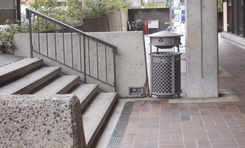
The final issue is the lane width.  In general, the lane should permit for two cyclists to ride next to each other.  This is especially important with children (the parents want to "cover" the street side), or for overtaking slower cyclists.  True, such 1.5-2m wide lanes are not feasible everywhere.  But one should avoid unnecessary bottlenecks.  Far too often the guardrails, traffic lights, and improperly installed curbstones narrow down otherwise adequate lane.
Bus stop done well.  Nordre Ringgade, Aarhus, DK.
Bus stop not done well.  It expects too much maneuvering in a narrow section of the bike lane.  One of the main thoroughfares in Tartu, Võru street.
A specific problem is posed by bus stops.  These are frequently located at a particularly narrow section of combined sidewalk/cycle lane where the shed and waiting people also take up space.  Bus stops require extra wide, not extra narrow lanes.  Inadequate width hurts more the fast riders.
Nordre Ringgade crossing Aldersrovej near Trøjborgcenteret.  All done well: no curbstones, the cycle lane retains it's width, and the profile is smooth.

*

Virtually none of the existing cycle lanes around Tartu follow these standards.  The quality has been improving from the perspective of slow riders but for long-distance cyclists the lanes are simply inadequate.  Realistically, I would recommend the planners the following:
  • Rename the current cycle lanes to "cycling-enabled sidewalks". Permit cycling there given one does not endanger pedestrians.  For faster riders, permit cycling on the car lanes as well.
  • Understand the different types of traffic.  Lanes for slow-speed riders need not to follow the same standards as high-speed thoroughfares.  Think what kind of traffic is dominating on certain streets.
  • Most importantly, before designing the next traffic project, learn about the capabilities and requirements of cyclists!  Bike lanes are costly, and if not constructed properly, they may be more of a hindrance than help for cyclists.

Tuesday, January 31, 2012

Tartu Eastern Beltway: How Does It Influence the Downtown?

The largest traffic project in the coming years in Tartu is possibly the Eastern Beltway, including a long bridge over Emajõgi. This should lead some traffic away from the overloaded streets in the inner city. I have never seen a discussion about the potential impact of it on the downtown and the city structure. I give a few thoughts here, mostly from pedestrian and cyclist perspective.

*
The beltway improves the accessibility of outskirts, including South Mall (Lõunakeskus).

The new bridge, road, and railway underpass will facilitate the access to South Mall and other far-lying areas for the inhabitants of Annelinn, the largest residential neighborhood in Tartu. In this way the customer base in the outskirts may grow at the expense of the downtown. True, it may crowd out primarily the smaller shopping centers in Annelinn itself and the impact on downtown may be limited—it depends on where Annelinn inhabitants currently do their shopping. However, I can hardly see how the opposite could happen—the new ring road improving the competitiveness of the inner city. There is one potential case though—more customers will be attracted to the less trafficked downtown when transit moves increasingly to the beltway. As the accessibility of the outer areas improves substantially more than that of downtown, I do not expect this to happen.

In the long run, better accessibility encourages businesses and public sector institutions to locate to the outskirts. This further increases one of the main obstacles for cycling/walking in Tartu—many important institutions are too far away and hardly accessible without a car.

*

Tartu Kaubamaja IMG 5271 C
Cyclists not welcome here...
The new road will slightly lessen the traffic in the central areas. However, the city will not use that opportunity by making the streets better accessible for pedestrians/cyclists.

The previous expensive traffic project—Freedom Bridge in downtown—was intended to facilitate the traffic on the other bridges. Unfortunately, there has been no major improvement for pedestrians in the related area (we can rather talk about a slight worsening because of the new street). Theoretically, part of improved accessibility for motorists might be transformed to better conditions for other modes of transportation as well. Almost none of it has happened in the downtown (two-way Lai street improves access for cyclists, but this was not the primary goal of the project). No bicycle lanes were added when the Riia-Turu junction was reconstructed, and those along Narva street are still hardly usable. The sidewalks along a number of much trafficked streets (Jakobi, Kroonuaia) are still very narrow.

I do not believe anything will be different when Eastern Beltway opens. Bicycle lanes will probably be constructed along the new road, and with some good luck these will be largely usable. However, nothing will be done in the more important central districts. There will still be a minor improvement as the traffic load in downtown will slightly fall.

*

A major boost for downtown would require fast, convenient, and affordable mass transit lines that cross in downtown.

I can imagine two light rail lines -- one from Ihaste to where the Institute of Physics is currently located, and another from Ülenurme to the location of the University of Life Sciences, crossing in downtown. If these trains are fast, frequent, and affordable, they could potentially bring people from many areas (including Annelinn) into the center.
I do not expect any of this to be realized in my lifetime, but some exploratory analysis might well be worth doing.

*

Eastern Beltway is a step toward making Tartu a sprawled city where efficient public transport is hardly feasible and distances are too long for cycling/walking. The municipality should consider counter moves.

Saturday, November 6, 2010

Directive 261: why the airlines should pay for hotel (and why they shouldn't)

Here I discuss the issues related to occasional cancellations, not caused by the airlines. These arguments may not be valid if the airline itself is the source of the problem, or in case of massive air traffic disruptions, such as the ash cloud of 2010.

By Jnpet [GFDL or CC-BY-SA-3.0], from Wikimedia Commons


There are two reasons to require airlines to provide food and lodging -- risk aversion and economies of scale. Humans do not like risk. They hate to change their plans in an unexpected and expensive way like when the flight is cancelled because of bad weather or industrial dispute. Obviously, the airlines hate to pay these costs as well. They simply collect the money from the passengers themselves in form of more expensive airfares. Essentially, the airlines act as insurance providers, charging passengers a little more for their flights, and providing food and shelter when needed. As airlines operate many flights, delays and cancellations occur quite often, and it is relatively easy for them to collect and maintain related funds.

Large firms can handle occasional disruptions lot easier than individual passengers. Hence it makes sense to shift more of the risk to the firms. Second, as airlines have a base or partner in the airport, it is easier for them to provide the hotel. Imagine yourself stranded in an airport far away with little money, extremely expensive cellphone prices and no idea about the hotels. How would you get to an affordable one? Airlines could easily (eventually through airports) make an agreement with a number of hotels and taxi companies. Even more, they have access to phones, internet and office facilities, which tremendously simplifies booking. It costs a lot less for them to do the actual bookings in case of cancellations.

*

The arguments above work best if all passengers are similar. But they differ. First, people have inherently different tendency to take risks. Second, your risk aversion depends on the circumstances. Your outbound flight was delayed? Bad, but not a big deal. Just go home and sleep till morning. You are probably not that interested in a hotel just a few blocks away from your home. However, if this happens to be your flight home, the situation is different. Third, people value lodging differently. A backpacker may find it completely acceptable to spend a few nights in the airport (in exchange for cheaper airfare), while others are willing to pay a lot for a good hotel.

*

The current directive 261 requires the airlines to offer a one-size-fits-all compulsory insurance. But sometimes you may rather want to get cheaper tickets and take the risk, another time you may want to pay even more to get better provision. The current directive does not allow for this kind of flexibility. Fortunately, there is an easy solution -- make the insurance voluntary, an explicit choice with corresponding price tag, while buying the tickets.

Does this mean that current directive 261 should be replaced by a voluntary insurance? Maybe. It depends on how different the passengers typically are, and whether they actually understand the risks and make the right choices. But it might be a good idea to experiment with this option.

This story is inspired by discussions with Idir Laurent Khiar. Here I use the opportunity to acknowledge his role.

Wednesday, September 29, 2010

Canceled Flights and who should bear the Risk

Flying is risky. In September 2010 airBaltic (BT) canceled a number of routes while shifting to the winter schedule. Although it is common in the airlines industry to operate a thinner schedule for the winter period (October till March), this particular process was related to many unexpected changes. BT canceled flights where they already had sold tickets, including a large sales campaign which ended just days before the canceling announcements. This led to number of accusation of BT being unreliable and unfair to customers.

However, the story is not quite that simple. Namely, according the the BT's representative Janis Vanags, "flexibility" is necessary in order to keep the prices low. I would add another dimension here -- flexibility, i.e. ability to change schedule and cancel flights, also encourages BT to start flights to more risky destinations. These include low-demand, seasonal, or otherwise unknown locations, where the firm may be quite uncertain about the business results. To put it briefly -- BT is cheap, and reaches many destination, exactly because it is flexible.

You, as a customer, should understand it as a take-it-or-leave-it deal. You get a cheap flight to a weird destination. But be aware: this airline is re-scheduling/canceling more than you might expect. To put it in a different way: compared to "traditional" airlines, BT is shifting more of the operating risks to the customers. This helps it to keep the prices low and the network large. Is it good or bad for the customers? It depends. If you are price sensitive and don't mind changing your holiday plans by a day or two, then it is a good deal. If you are a business traveler booking your tickets just a few days before you fly, it is fine as well (the schedule changes are usually announced about a month in advance). If you are not flexible -- bad luck. Consider another airline if there is an affordable alternative nearby.

Can we conclude that last-minute changes in schedule are fine? Not quite. The problem is that customers may not aware of the actual risks. The majority of airlines are following their schedule closely long time in advance. BT seems to be somewhat free-riding on this perception of reliability. The best solution may be to make the customers aware of the related risks, given they are actually able to make use of this type of statistics.

Traveling long distances is a risky business. You either have to pay the insurance, or take the risk.

Saturday, April 3, 2010

Eesti lennundus: kas ja kui palju otseliine

Rohkem otseliine on head kuid ka tihedast ühendusest lähedaste keskustega on palju abi.
*
Viimasel ajal on ajakirjanduses olnud korduvalt juttu Eesti lennunduse (kehvast) seisust. Peamise probleemina tõstetakse esile otseühenduste vähesus Tallinnast, aga just otseühendused toovad riiki turiste, investeeringuid, ning rahvusvahelisi üritusi. Ma ei hakka neid mõtteid siin kordama. See kõik on õige. Põhjendan siin hoopis, miks peaks riiklik poliitika peaks keskenduma ka teist tüüpi lendudele, muu hulgas tihedale ühendusele Riiaga.
Peamine põhjus on see, et Tallinna lennujaama tagalas ei ole suure otseühenduste arvu jaoks piisavalt elanikke ning airBalticuga võrreldava võrgustiku loomiseks vajalikke investeeringuid ei ole silmapiiril näha. Seega, kuigi otseühendused on olulised nii turistide kui ärimeeste mõttes, peab suurem osa Euroopast siia ikkagi lendama ümberistumisega. Selles mõttes on Helsingi ning Riia lennujaama lähedus Tallinnale suur eelis. Tänu oma kompaktsusele ning airBalticu äristrateegiale võimaldab Riia tavatult lühikesi ümberistumise aegu, Helsingi pakub aga häid ühendusi ka kaugete paikadega. Seega, kui olulised ärimehed tulevad väga erinevatest keskustest, siis võib parim valik olla hoopis Tallinn-Riia ühenduste tihendamine ja sihtkohtade arvu suurendamine Riias. See võib tunduda natuke paradoksaalne, kuid selleks et 10 investorit nädalas Madriidist Tallinnasse tuua, ei ole võimalik lennuliini avada. Aitame parem lätlastel seda teha ja võimaldame ärimeestel kiiresti Riiast edasi saada. Lisaks pole neile, kes tegutsevad Pärnu-Tartu joonest lõuna pool, otselennud Tallinnast sugugi "otsemad" kui Riiast. Ka vastupidine võib olla õige: kui enamus investoreid pärineb Londonist ja Frankfurdist, siis tuleks (vajadusel dotatsiooniga) avada kaks lendu päevas nimetatud sihkohtadesse.
Teiseks, inimeste aja ning hinnaeelistused on erinevad. Kui tööreisijad eelistavad pigem kalleid ja kiireid ühendusi, siis paljud on nõus ümber istuma või 4 tundi bussiga sõitma, et saada odavale Rynairi lennule. Sellele reisijatehulgale on abi ainult odavatest otseühendustest. Kui me toetame ärireisijaid nõu ja jõuga, siis kas ärimeestest on ikka palju rohkem abi kui kultuurireisidest, õpilasvahetustest ning vähemrahakatest turistidest? Ka kunstnike ja tudengite liikumisel on ühiskonnale positiivne roll. Sellise hinnatundlikuma seltskonna huvides võiks olla hoopis maismaa traspordiühenduste parandamine (rongiühendus!).
*
Kokkuvõttes: lähedane ning tihedasti Tallinnaga ühendatud hub Riia võib mängida olulist rolli ärisidemete loomisel. Lisaks sobib suurele osale Eesti elanikkonnast soodsamate hindade nimel ümberistumisega reisimine.